Three ways to explore the Great North Road
 Before the Sydney Newcastle Freeway was The Great North Road. Totaling a distance of 240 kilometers the road was built by convict labor between 1826 and 1836.
European settlers were lured into the Hunter Valley by productive land and soon demanded a road be built to connect settlements and to transport supplies in and out. Unfortunately the road never became a popular connection due to improvements in shipping and the road was considered to be too remote - think feed and water for horses and bullocks rather than the fast food drive thru's and petrol stations of today.
That’s the short version of the story, the longer version can be found here.
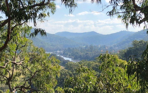
Today parts of the road can still be driven but other parts are closed to vehicles making them the perfect playground for bushwalkers and mountain bikers. While it isn’t the fastest route for Sydney siders to make their way into wine country it’s definitely a great way to go for those who prefer the road less travelled and take a look around.
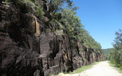
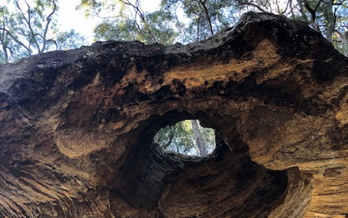
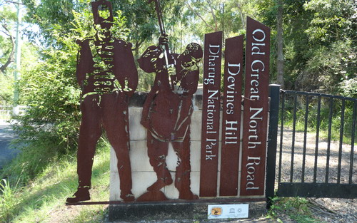 There was a grand vision behind the Great North Road - the new colonial administrators wanted to prove to the mother country they were able to build quality infrastructure. The Devines Hill and Finches Line part of the Great North Road are one of the 11 Australian Convict Sites that are World Heritage listed. It really has to be seen to be believed the fact that hundreds of exiled lawbreakers built such advanced, long lasting and functional structures.
The road is considered to be a great feat of engineering with remnants including stone retaining walls, wharves, culverts, bridges and buttresses. These can still be appreciated right along the entire Great North Road even in busy Sydney City suburbs including Epping and Gladesville, right through to the more remote parts of the road at Wisemans Ferry in Dharug and Yengo National Parks.
 Best ways to experience the road:
1. Bushwalking
Wear your hiking shoes to walk the 4 hour circuit of The Great North Road (Devine’s Hill to Finches lane).
This is a relatively easy circuit walk, a good one for family groups and it has quite a lot of interpretation along the way. It’s very scenic offering very picturesque outlooks, stunning rock formations, and a great snapshot of native plants (and wildlife if you are lucky, too).
For more information:
- This Bushwalk is featured in the Best Bushwalks in the Hawkesbury Edition 1
- National Parks Visitor Information – Old Great North Road World Heritage Walk
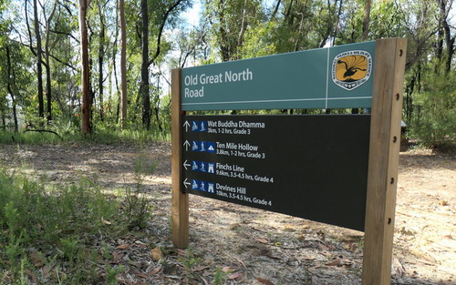 2. Mountain Bike
For those comfortable in the saddle take this 28km mountain bike accessible loop. This trip is better suited to more experienced riders.
For more information:
- National Parks Visitor Information – for Devines Hill Loop.
For more information:
- The Hawkesbury Visitor information Centre also sells topographic maps for the more hard core exploring the non drivable sections to the north of Wiseman’s Ferry.
- National Parks Visitor Information on the Old Great North Road World Heritage Walk.
3. By Car
Follow the entire route from Sydney to Newcastle.
Plan ahead to follow the route by road - parts of the trip are remote and parts are on dirt road. You won't be able to drive on the closed section between Wisemans Ferry and Bucketty but there is an alternate route via Settlers Road to St Albans and then following the St Albans Road to Mogo Creek.
Call in to the Hawkesbury Visitor Information Centre for your free printed copy of the Great North Road Convict Trail Map.
*Please note: Mobile reception is not available in all areas so ensure you have a map and someone knows where you are.
However you choose to explore this interesting road and the Hawkesbury region it runs through we know you will be glad you did it. What are you waiting for, plan your trip now.
We've provided links and information in the article for your convenience however please contact us at the Hawkesbury Visitor information Centre if you need more information to plan your trip or collect or purchase printed maps.
Discover more....
-
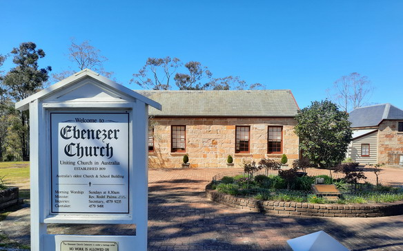
Australia's oldest (and cutest!) church at Ebenezer
Jul 7, 2021
Loved by locals, tourists, historians and volunteers
-
Step back in time
Nov 3, 2020
Transport yourself to another time in Sydney's history with these Windsor favourites
Read more
-
Local myth or fact? The secret rum smuggler tunnels
Jul 2, 2020
The mystery of the secret tunnels criss-crossing old Windsor
Read more